全国测绘法宣传日 | “实景三维中国”建设:智“绘”立体中国
在大熊猫国家公园,“滚滚”们正享受着360°无死角的保护。随着实景三维技术不断发展,数字孪生平台、“天空地”一体化监测体系、大熊猫保护5G消息应用、AI“熊猫脸”识别等在线系统相继诞生,正努力为大熊猫及其8000多种伴生动植物打造更加安全舒适的“智能新家”。
In the Giant Panda National Parkin west China, the pandas are enjoying 360-degree protection. The continuous development of 3D real-scene technologies has led to the emergence of digital twin platforms, integrated monitoring systems covering the space from sky to ground, 5G messaging applications for panda conservation, and AI-based “panda face” recognition systems. Combined efforts are being made to create a safer and more comfortable “smart home” for the giant pandas and the more than 8,000 associated plant and animal species.

大熊猫的“智能新家”离不开地理信息的精确采集与处理技术的发展。2022年,中国全面开展“实景三维中国”建设,主要包括五个维度:地形级、城市级、部件级的实景三维建设,以及物联感知数据接入与融合、在线系统与支撑环境建设。
The creation of the giant pandas’ “smart home”relies on the development of precise geographic information collection and processing technologies. In 2022, China has launched the comprehensive development of “3D Real-Scene China.” This initiative encompasses five dimensions: the development of 3D real scene at the terrain level, urban level, and component level, as well as the integration of Internet of Things (IoT) sensing data and the development of online systems and supporting environments.
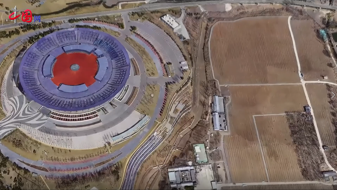
固有“天府之国”之称的四川省为打造更高水平的“天府粮仓”,以3厘米倾斜摄影生产的实景三维模型为“骨架”,利用其“所见即所得”的特点,构建电子栅栏,实现对耕地的智慧化、无人化“看护”。2023年,成都平原7500平方千米的区域已被实景三维模型全部覆盖。
Southwest China’s Sichuan Province, known as the land of abundance, is striving to create a more advanced major granary of the country. Using 3D real-scene models produced through 3cm-precision oblique photography as the “skeleton,” the province is leveraging its “true-to-life” feature to build an electronic fence, enabling intelligent and unmanned guarding of cultivated land. By 2023, an area of 7,500 square kilometersof the Chengdu Plainhad been fully covered by 3D real-scene models.

目前,中国共计26个省(区、市)的264个城市已开展实景三维模型建设,在不久的将来,政府决策、生产调度和生活规划均可通过线上实景三维空间完成。
Currently, a total of 264 cities in 26 provincial-level regions in China are developing 3D real-scene models. In the near future, government decision-making, production scheduling, and urban planning can all be facilitated through online 3D real scenes.
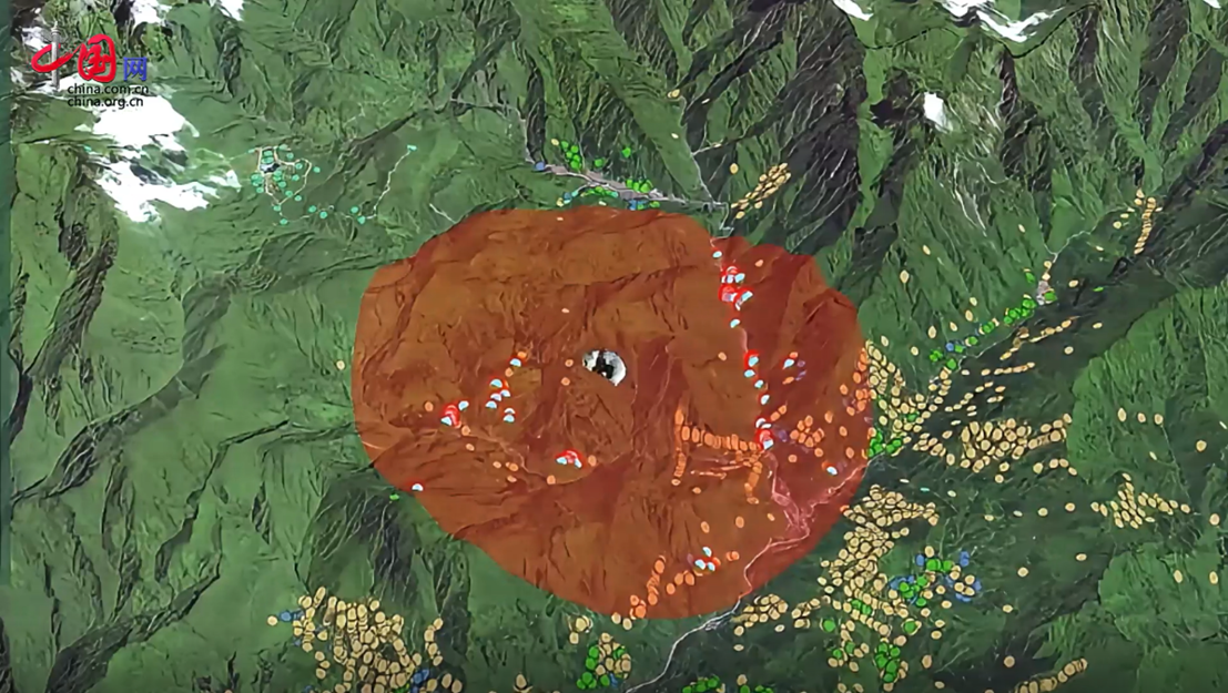
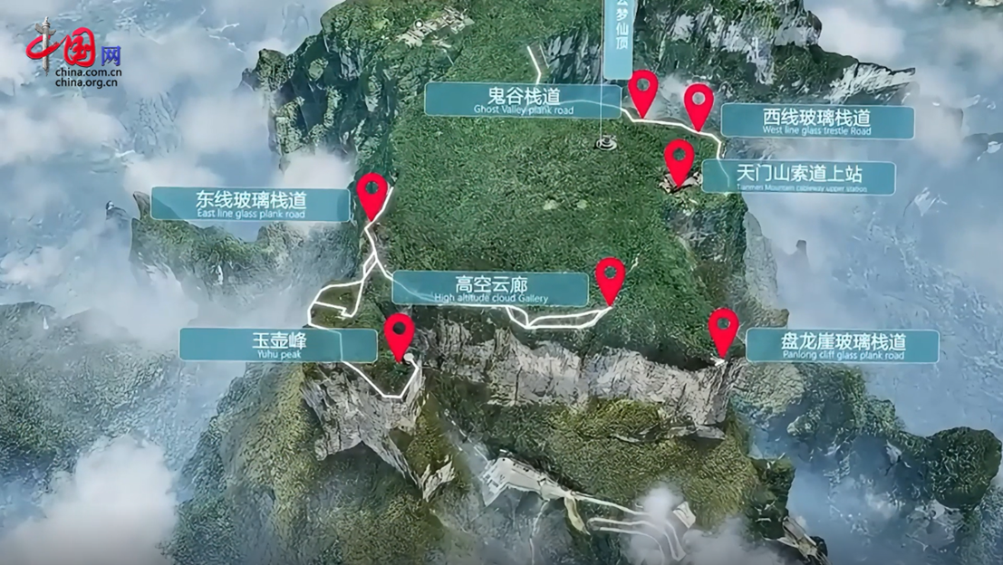
湖南张家界作为电影《阿凡达》异世界的原型,地形地貌复杂险峻。通过对景区进行高精度三维建模,不仅用数字化的方式呈现出了张家界的“一草一木”,更识别出多处存在风险的危岩体,为地质监测和灾害防治提供了重要依据。一个个核心景区和场馆的三维模型构成的VR地图,带游客“云”游张家界,并提供各类服务。
As the prototype of the alien world in the movie “Avatar,” Zhangjiajie in central China’s Hunan Province boasts a complex and rugged terrain. Through high-precision 3D modeling of the scenic area, not only has the digital representation of the natural environment in Zhangjiajie been realized, but also multiple risky rock formations have been identified, providing important basis for geological monitoring and disaster prevention. A VR map composed of 3D models of core scenic areas and venues allows tourists to virtually explore Zhangjiajie and provides various services.

实景三维能在“复刻”现实世界的同时,接入空间位置、互联网等物联感知数据,实现数字空间与现实空间的实时关联互通,并通过数据融合与共享,为数字政府、数字经济发展提供重要的数据资源,是数字中国建设的“立体蓝图”。
3D real-scene technology not only replicates the real world but also integrates spatial positioning and IoT data, enabling real-time correlation and interaction between digital and physical spaces. By harnessing data fusion and sharing, it provides valuable data resources for the development of digital government and digital economy, thus serving as a three-dimensional blueprint for the development of Digital China.

在第21个“全国测绘法宣传日”到来之际,中国聚焦于世界新一轮技术革命浪潮,实景三维中国建设,助力地理测绘行业迈向更加智慧、高效的新纪元。
On the occasion of the 21st National Surveying and Mapping Law Promotion Day, China is riding on the global wave of the new technological revolution with the development of the 3D Real-Scene China initiative, which is poised to propel the geospatial surveying and mapping industry into a new era ofelevated intelligence and efficiency.


